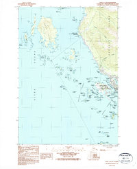
1987 Map of Sitka A-5 SE
USGS Topo · Published 1987About this map
The coastal community of Sitka occupies the eastern edge of this maritime survey, illustrating the complex geography of Baranof Island and the surrounding archipelagos. The layout of the town is closely tied to its waterways, with the Sitka Harbor sheltered by a cluster of smaller landmasses including Japonski Island, which serves as the location for the Municipal Airport. Inland, the landscape is defined by drainage systems such as Granite Creek and Cascade Creek, alongside infrastructure like a Pumping Sta and a Quarry that speak to the local development during the late twentieth century.
Find a feature on this map
77 named features on this map. Tap any name to fly to it.
Don’t see what you’re looking for? This feature index may not catch every label — zoom into the map to look around manually.
Map Details
Editions of this 1987 Sitka A-5 SE Map
This is the sole edition of this map. No revisions or reprints were ever made.
Other maps of this area

1948 · Sitka A-5
USGS Topo · 1:63,360

1951 · Port Alexander D-5
USGS Topo · 1:63,360

1951 · Sitka
USGS Topo · 1:250,000

1951 · Port Alexander D-4
USGS Topo · 1:63,360

1951 · Port Alexander
USGS Topo · 1:250,000

1951 · Sitka A-4
USGS Topo · 1:63,360

1951 · Sitka A-5
USGS Topo · 1:63,360

1952 · Port Alexander
USGS Topo · 1:250,000

1952 · Sitka
USGS Topo · 1:250,000

1954 · Sitka A-4
USGS Topo · 1:63,360