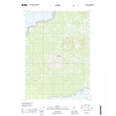
2017 Map of Sitka A-6 SE
USGS Topo · Published 2017About this map
Mt Edgecumbe dominates the southern reaches of Kruzof Island in this coastal Alaskan study, its distinct volcanic cone rising within the Tongass National Forest. To the north, the topographic relief shifts toward Crater Ridge, illustrating the island's complex geothermal history and volcanic landscape. The coastline is defined by the open Gulf of Alaska to the west and the sheltered waters of Sitka Sound to the southeast. Small landforms including Lava Island, Liesnoi Island, and Goloi Island cluster near the shore, marking the transition from the forested mountain slopes to the rugged marine environment of the Alexander Archipelago.
Find a feature on this map
14 named features on this map. Tap any name to fly to it.
Don’t see what you’re looking for? This feature index may not catch every label — zoom into the map to look around manually.
Map Details
Editions of this 2017 Sitka A-6 SE Map
This is the sole edition of this map. No revisions or reprints were ever made.
Other maps of this area

1948 · Sitka A-5
USGS Topo · 1:63,360

1951 · Sitka A-6
USGS Topo · 1:63,360

1951 · Port Alexander D-5
USGS Topo · 1:63,360

1951 · Sitka
USGS Topo · 1:250,000

1951 · Port Alexander
USGS Topo · 1:250,000

1951 · Sitka A-5
USGS Topo · 1:63,360

1952 · Port Alexander
USGS Topo · 1:250,000

1952 · Sitka
USGS Topo · 1:250,000

1964 · Sitka
USGS Topo · 1:250,000

1964 · Port Alexander
USGS Topo · 1:250,000