
1951 Map of Sitka A-6
USGS Topo · Published 1956About this map
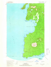
Mt Edgecumbe dominates the southern landscape of Kruzof Island in this mid-century survey, its symmetrical volcanic profile rising above the surrounding coastal forest. The map documents a sparsely inhabited wilderness where human presence is marked only by remote outposts such as Cabins near Iris Meadows and a Shelter Cabin at the terminus of a coastal Trail. To the south, the St Lazaria Nat Wildlife Refuge encompasses St Lazaria Is, protecting the avian habitats at the entrance to Sitka Sound. The intricate shoreline of the western coast is defined by deep inlets like Gilmer Bay and Shelikof Bay, separated by high ground at Crater Ridge and Shell Mtn. This topographic record, compiled from 1948 aerial photography, provides a detailed view of the island's natural drainage systems, including Freds Creek and the marshy expanses of the interior meadows.
Find a feature on this map
27 named features on this map. Tap any name to fly to it.
Don’t see what you’re looking for? This feature index may not catch every label — zoom into the map to look around manually.
Map Details
Editions of this 1951 Sitka A-6 Map
4 editions found
Other maps of this area

1948 · Sitka A-5
USGS Topo · 1:63,360

1948 · Sitka B-5
USGS Topo · 1:63,360

1951 · Sitka B-6
USGS Topo · 1:63,360

1951 · Sitka B-5
USGS Topo · 1:63,360

1951 · Port Alexander D-5
USGS Topo · 1:63,360

1951 · Sitka
USGS Topo · 1:250,000

1951 · Port Alexander
USGS Topo · 1:250,000

1951 · Sitka A-5
USGS Topo · 1:63,360

1952 · Port Alexander
USGS Topo · 1:250,000

1952 · Sitka
USGS Topo · 1:250,000