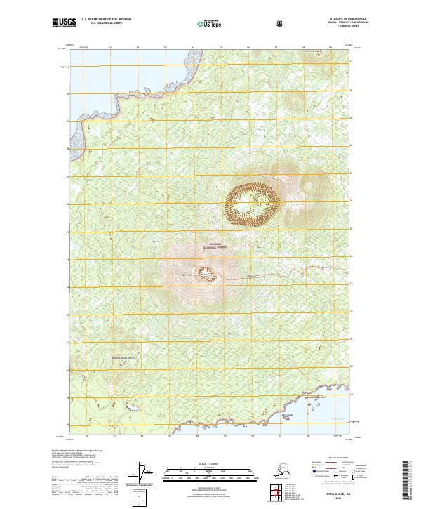
2021 Map of Sitka A-6 SE
USGS Topo · Published 2021About this map
Mt Edgecumbe dominates the center of Kruzof Island within the Tongass National Forest, its volcanic cone rising sharply above the surrounding landscape. The Mt Edgecumbe Trl provides a clear path of ascent for those navigating this portion of the Sitka archipelago. To the northwest, the terrain ascends toward Shell Mtn, while the southwestern slopes transition into the lower elevations near Montana de San Jacinto. The coastline is characterized by a series of small islands, including Liesnoi Island, Goloi Island, and Kava Island, which separate the mainland mass from the open waters of Sitka Sound. Inland water features are sparse, though Freds Cr drains the northern reaches. This 2021 survey illustrates the topographical isolation of the Kruzof wilderness before it reaches the coastal fringes where maritime and forest environments meet.
Find a feature on this map
14 named features on this map. Tap any name to fly to it.
Don’t see what you’re looking for? This feature index may not catch every label — zoom into the map to look around manually.
Map Details
Editions of this 2021 Sitka A-6 SE Map
This is the sole edition of this map. No revisions or reprints were ever made.
Other maps of this area

1948 · Sitka A-5
USGS Topo · 1:63,360

1951 · Sitka A-6
USGS Topo · 1:63,360

1951 · Port Alexander D-5
USGS Topo · 1:63,360

1951 · Sitka
USGS Topo · 1:250,000

1951 · Port Alexander
USGS Topo · 1:250,000

1951 · Sitka A-5
USGS Topo · 1:63,360

1952 · Port Alexander
USGS Topo · 1:250,000

1952 · Sitka
USGS Topo · 1:250,000

1964 · Sitka
USGS Topo · 1:250,000

1964 · Port Alexander
USGS Topo · 1:250,000