
1951 Map of Sitka B-1
USGS Topo · Published 1972About this map
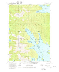
Admiralty Island's intricate coastline is revealed in this mid-century survey, focusing on the complex waterways of Pybus Bay and Gambier Bay. The landscape is dominated by high peaks such as Soapberry Mountain, Middle Mountain, and Bear Pass Mountain, with drainage flowing into narrow inlets like North Arm Hood Bay and South Arm Hood Bay. Evidence of coastal activity is found at Cannery Cove and Eliza Harbor, while numerous small landforms including the San Juan Islands, Midway Islands, and Elliott Island dot the West Channel. This 1951 record, which includes minor revisions from the early 1970s, documents the maritime geography within the Tongass National Forest, showing several Cabins and a Cabin along the shoreline. The extensive Tidal Flat areas at the head of the bays highlight the dramatic tidal range that characterizes this part of the Alexander Archipelago.
Find a feature on this map
25 named features on this map. Tap any name to fly to it.
Don’t see what you’re looking for? This feature index may not catch every label — zoom into the map to look around manually.
Map Details
Editions of this 1951 Sitka B-1 Map
2 editions found
Other maps of this area

1948 · Sitka B-1
USGS Topo · 1:63,360

1948 · Sitka C-2
USGS Topo · 1:63,360

1948 · Sitka A-2
USGS Topo · 1:63,360

1948 · Sitka C-1
USGS Topo · 1:63,360

1948 · Sumdum A-6
USGS Topo · 1:63,360

1948 · Sumdum B-6
USGS Topo · 1:63,360

1948 · Sumdum C-6
USGS Topo · 1:63,360

1948 · Sitka B-2
USGS Topo · 1:63,360

1948 · Sitka A-1
USGS Topo · 1:63,360

1951 · Sitka
USGS Topo · 1:250,000