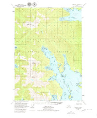
1951 Map of Sitka B-1
USGS Topo · Published 1980About this map
Admiralty Island National Monument dominates this coastal landscape, showing a wilderness of Southeast Alaska before modern development. The map details a complex maritime environment where steep peaks like Bear Pass Mountain and Soapberry Mountain descend sharply into deep waters. The shoreline is punctuated by sheltered inlets such as Cannery Cove and Donkey Bay, which likely served as crucial refuge and operational points for the local fishing and canning industries of the mid-20th century.
Find a feature on this map
30 named features on this map. Tap any name to fly to it.
Don’t see what you’re looking for? This feature index may not catch every label — zoom into the map to look around manually.
Map Details
Editions of this 1951 Sitka B-1 Map
2 editions found

Other maps of this area

1948 · Sitka B-1
USGS Topo · 1:63,360

1948 · Sitka C-2
USGS Topo · 1:63,360

1948 · Sitka A-2
USGS Topo · 1:63,360

1948 · Sitka C-1
USGS Topo · 1:63,360

1948 · Sumdum A-6
USGS Topo · 1:63,360

1948 · Sumdum B-6
USGS Topo · 1:63,360

1948 · Sumdum C-6
USGS Topo · 1:63,360

1948 · Sitka B-2
USGS Topo · 1:63,360

1948 · Sitka A-1
USGS Topo · 1:63,360

1951 · Sitka
USGS Topo · 1:250,000