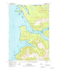
1951 Map of Sitka B-2
USGS Topo · Published 1978About this map
Angoon and the nearby Killisnoo Ruins anchor this coastal study of Admiralty Island, where the Tlingit community's traditional landscape meets the industrial footprints of the early 20th century. The map details a complex maritime environment within the Tongass National Forest, centered on the sheltered waters of Killisnoo Harbor and Favorite Bay. Evidence of localized industry appears in the Coal Claim near the North Arm of Hood Bay, while the infrastructure of the era is marked by the Seaplane Base and the Kootznahoo Roads.
Find a feature on this map
33 named features on this map. Tap any name to fly to it.
Don’t see what you’re looking for? This feature index may not catch every label — zoom into the map to look around manually.
Map Details
Editions of this 1951 Sitka B-2 Map
2 editions found

Other maps of this area

1948 · Sitka B-3
USGS Topo · 1:63,360

1948 · Sitka B-1
USGS Topo · 1:63,360

1948 · Sitka A-3
USGS Topo · 1:63,360

1948 · Sitka C-2
USGS Topo · 1:63,360

1948 · Sitka A-2
USGS Topo · 1:63,360

1948 · Sitka C-3
USGS Topo · 1:63,360

1948 · Sitka C-1
USGS Topo · 1:63,360

1948 · Sitka B-2
USGS Topo · 1:63,360

1948 · Sitka A-1
USGS Topo · 1:63,360

1951 · Sitka
USGS Topo · 1:250,000