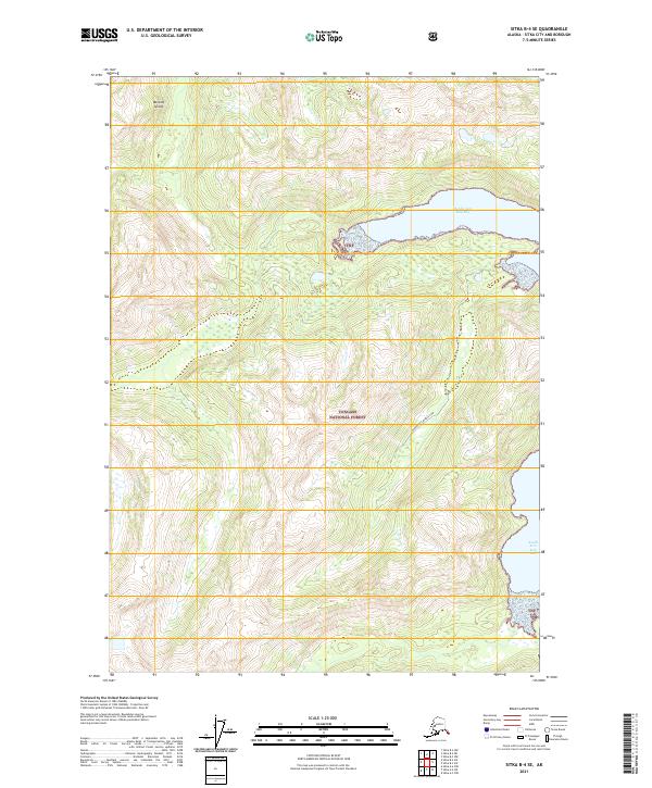
2021 Map of Sitka B-4 SE
USGS Topo · Published 2021About this map
Baranof Island is the centerpiece of this coastal survey, where the maritime landscape of Southeast Alaska meets the vast Tongass National Forest. The topography is dominated by the complex shoreline of Kelp Bay, specifically the deep inlets of Middle Arm Kelp Bay and South Arm Kelp Bay. These waters, protected by the dense forests of the TNF, illustrate the isolated and undeveloped character of the Alexander Archipelago. Mapping of the Bourbon Ck Middle Arm provides specific detail for navigators and those studying the drainage patterns of this wilderness area. The map serves as a contemporary record of federal land management boundaries, including sections of t52s r64e and t53s r65e, within one of the nation's most significant temperate rainforests.
Find a feature on this map
10 named features on this map. Tap any name to fly to it.
Don’t see what you’re looking for? This feature index may not catch every label — zoom into the map to look around manually.
Map Details
Editions of this 2021 Sitka B-4 SE Map
This is the sole edition of this map. No revisions or reprints were ever made.
Other maps of this area

1948 · Sitka B-3
USGS Topo · 1:63,360

1948 · Sitka A-3
USGS Topo · 1:63,360

1951 · Sitka B-4
USGS Topo · 1:63,360

1951 · Sitka
USGS Topo · 1:250,000

1951 · Sitka A-4
USGS Topo · 1:63,360

1951 · Sitka B-3
USGS Topo · 1:63,360
1951 · Sitka A-3
USGS Topo · 1:63,360

1952 · Sitka
USGS Topo · 1:250,000

1954 · Sitka A-4
USGS Topo · 1:63,360

1964 · Sitka
USGS Topo · 1:250,000