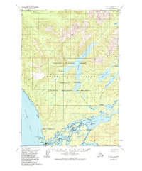
1951 Map of Sitka C-2
USGS Topo · Published 1984About this map
Angoon sits at the southwestern edge of this landscape, positioned where Chatham Strait meets the complex waterways of Kootznahoo Inlet. This 1951 field-annotated survey reveals a specialized coastal infrastructure, including a Lighthouse Reserve, a Seaplane Anchorage, and the Thayer Lake Lodge on the northern shore of Thayer Lake. The map details the transition from the marine environment of Mitchell Bay to the interior wilderness of Admiralty Island National Monument.
Find a feature on this map
56 named features on this map. Tap any name to fly to it.
Don’t see what you’re looking for? This feature index may not catch every label — zoom into the map to look around manually.
Map Details
Editions of this 1951 Sitka C-2 Map
2 editions found

Other maps of this area

1948 · Sitka B-3
USGS Topo · 1:63,360

1948 · Sitka D-1
USGS Topo · 1:63,360

1948 · Sitka B-1
USGS Topo · 1:63,360

1948 · Sitka C-2
USGS Topo · 1:63,360

1948 · Sitka C-3
USGS Topo · 1:63,360

1948 · Sitka D-3
USGS Topo · 1:63,360

1948 · Sitka D-2
USGS Topo · 1:63,360

1948 · Sitka C-1
USGS Topo · 1:63,360

1948 · Sitka B-2
USGS Topo · 1:63,360

1951 · Sitka
USGS Topo · 1:250,000