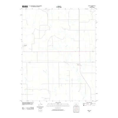
2009 Map of Sitka
USGS Topo · Published 2009About this map
Sitka serves as the focal point of this Clark County landscape, situated where the high plains are carved by the winding paths of Day Creek and Spring Creek. The map records a quiet agricultural era in western Kansas, defined by a sparse network of section-line roads and wide-open rangeland. Local history is anchored at the Saint Josephs and Highland Cemetery in the northwest, a significant site for genealogists tracking early families of the region. Transportation routes like Mt Jesus Rd and Sitka Rd navigate the drainage patterns of the creeks, illustrating how the natural topography continues to dictate the placement of rural infrastructure even in the 21st century. This survey provides a precise view of the settlement's footprint and the surrounding hydrology before further modern development.
Find a feature on this map
6 named features on this map. Tap any name to fly to it.
Don’t see what you’re looking for? This feature index may not catch every label — zoom into the map to look around manually.
Map Details
Editions of this 2009 Sitka Map
This is the sole edition of this map. No revisions or reprints were ever made.
Other maps of this area

1894 · Sitka
USGS Topo · 1:62,500

1896 · Ashland
USGS Topo · 1:125,000

1955 · Pratt
USGS Topo · 1:250,000

1959 · Pratt
USGS Topo · 1:250,000
1972 · Ashland SE
USGS Topo · 1:24,000
1972 · Ashland
USGS Topo · 1:24,000

1979 · Sitka
USGS Topo · 1:24,000

1979 · Bloom SE
USGS Topo · 1:24,000

1979 · Sugarloaf
USGS Topo · 1:24,000
1979 · Sitka SW
USGS Topo · 1:24,000