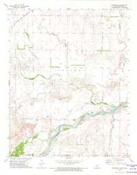
1972 Map of Ashland SE
USGS Topo · Published 1974About this map
The Cimarron River winds through the southern portion of this landscape, defining the border between Clark County and Harper County. This 1970s survey captures a transition between the high plains of Kansas and the northern edges of Oklahoma, marked by the prominent Old Indian Treaty Boundary that cuts across the river valley. The drainage patterns of the region are exceptionally detailed, showing the convergence of Big Sandy Creek, Little Sandy Creek, and the uniquely named Stink Creek.
Find a feature on this map
12 named features on this map. Tap any name to fly to it.
Don’t see what you’re looking for? This feature index may not catch every label — zoom into the map to look around manually.
Map Details
Editions of this 1972 Ashland SE Map
This is the sole edition of this map. No revisions or reprints were ever made.
Other maps of this area

1894 · Sitka
USGS Topo · 1:62,500

1896 · Ashland
USGS Topo · 1:125,000

1955 · Woodward
USGS Topo · 1:250,000

1955 · Pratt
USGS Topo · 1:250,000

1958 · Woodward
USGS Topo · 1:250,000

1959 · Pratt
USGS Topo · 1:250,000

1970 · Buffalo NW
USGS Topo · 1:24,000
1970 · Rosston NW
USGS Topo · 1:24,000

1970 · Rosston NE
USGS Topo · 1:24,000

1972 · Ashland NW
USGS Topo · 1:24,000