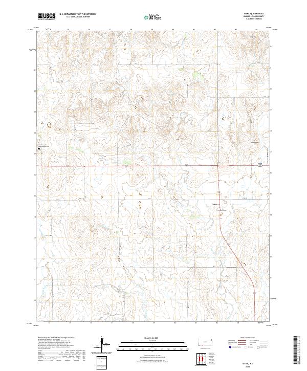
2022 Map of Sitka
USGS Topo · Published 2022About this map
Sitka serves as the central point of reference in this corner of Clark County, situated where Sitka Rd meets the regional road network. The landscape is defined by the drainage patterns of Day Cr and Spring Cr, which carve through the open plains. In the northwestern section of the map, the Saint Joseph's and Highland Cem provides a significant touchstone for genealogists and local historians, anchoring the surrounding rural landscape. The grid of county roads, including CR U and CR Q, illustrates the organized division of land into sections, a characteristic of this part of Kansas. This 2022 data shows the persistent layout of these rural corridors and the localized importance of Sitka within the broader agricultural and ranching environment of the High Plains.
Find a feature on this map
22 named features on this map. Tap any name to fly to it.
Don’t see what you’re looking for? This feature index may not catch every label — zoom into the map to look around manually.
Map Details
Editions of this 2022 Sitka Map
This is the sole edition of this map. No revisions or reprints were ever made.
Other maps of this area

1894 · Sitka
USGS Topo · 1:62,500

1896 · Ashland
USGS Topo · 1:125,000

1955 · Pratt
USGS Topo · 1:250,000

1959 · Pratt
USGS Topo · 1:250,000
1972 · Ashland SE
USGS Topo · 1:24,000
1972 · Ashland
USGS Topo · 1:24,000

1979 · Sitka
USGS Topo · 1:24,000

1979 · Bloom SE
USGS Topo · 1:24,000

1979 · Sugarloaf
USGS Topo · 1:24,000
1979 · Sitka SW
USGS Topo · 1:24,000