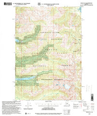
1997 Map of Sitka D-2
USGS Topo · Published 2000About this map
Admiralty Island dominates this 1997 revision, showcasing the managed wilderness of southeast Alaska's coastal rainforest. The landscape is defined by the Admiralty Island National Monument and the extensive Kootznoowoo Wilderness, areas designated for their unique ecological value. Small outposts of human activity are limited to Forest Service infrastructure, including the Lake Kathleen Cabin (FS) and two sites on the shores of Lake Florence — the East Lake Florence Cabin (FS) and West Lake Florence Cabin (FS).
Find a feature on this map
16 named features on this map. Tap any name to fly to it.
Don’t see what you’re looking for? This feature index may not catch every label — zoom into the map to look around manually.
Map Details
Editions of this 1997 Sitka D-2 Map
This is the sole edition of this map. No revisions or reprints were ever made.
Other maps of this area

1948 · Juneau A-3
USGS Topo · 1:63,360

1948 · Sitka D-1
USGS Topo · 1:63,360

1948 · Sitka C-2
USGS Topo · 1:63,360

1948 · Sitka C-3
USGS Topo · 1:63,360

1948 · Sitka D-3
USGS Topo · 1:63,360

1948 · Sitka D-2
USGS Topo · 1:63,360

1948 · Sitka C-1
USGS Topo · 1:63,360

1950 · Juneau A-3
USGS Topo · 1:63,360

1951 · Juneau
USGS Topo · 1:250,000

1951 · Juneau A-2
USGS Topo · 1:63,360