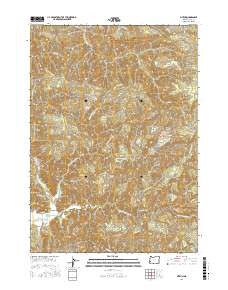
2017 Map of Sitkum
USGS Topo · Published 2017About this map
Sitkum lies along the banks of the East Fork Coquille River, serving as a central point in this heavily dissected landscape of the Oregon Coast Range. The settlement is connected to the wider region by the Coos Bay Wagon Rd, a route with deep historical roots for transport between the coast and the interior. The surrounding terrain is defined by prominent elevations such as Burnt Mtn and the long stretch of Burnt Ridge, while deep drainages like Brewster Canyon and Brummit Cr shape the local topography.
Find a feature on this map
48 named features on this map. Tap any name to fly to it.
Don’t see what you’re looking for? This feature index may not catch every label — zoom into the map to look around manually.
Map Details
Editions of this 2017 Sitkum Map
This is the sole edition of this map. No revisions or reprints were ever made.
Other maps of this area

1928 · Sitkum
USGS Topo · 1:125,000

1955 · Camas Valley
USGS Topo · 1:62,500

1955 · Ivers Peak
USGS Topo · 1:62,500

1955 · Sitkum
USGS Topo · 1:62,500

1955 · Tyee
USGS Topo · 1:62,500

1958 · Roseburg
USGS Topo · 1:250,000

1959 · Roseburg
USGS Topo · 1:250,000

1979 · Roseburg
USGS Topo · 1:100,000
1990 · Remote
USGS Topo · 1:24,000
1990 · Cedar Creek
USGS Topo · 1:24,000