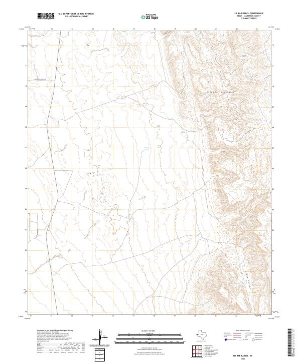
2022 Map of Six Bar Ranch
USGS Topo · Published 2022About this map
The Delaware Mountains dominate the eastern half of this Culberson County landscape, where steep contour gradients define the transition from the high ridges down to the western flats. Water management in this arid West Texas environment is evidenced by features like Windy Tank and Hogue Tank, which represent critical infrastructure for ranching operations in the region. Transportation is primarily limited to sparse desert tracks and Guadalupe School Rd, reflecting the remote and specialized land use of the area. Significant drainage patterns are carved into the limestone and sandstone uplift, most notably through Hogue Canyon and Black Canyon, which channel seasonal runoff from the higher elevations toward the basins below.
Find a feature on this map
6 named features on this map. Tap any name to fly to it.
Don’t see what you’re looking for? This feature index may not catch every label — zoom into the map to look around manually.
Map Details
Editions of this 2022 Six Bar Ranch Map
This is the sole edition of this map. No revisions or reprints were ever made.
Other maps of this area

1933 · Guadalupe Peak
USGS Topo · 1:48,000

1940 · Guadalupe Peak
USGS Topo · 1:62,500

1954 · Van Horn
USGS Topo · 1:250,000

1958 · Van Horn
USGS Topo · 1:250,000

1973 · Bitter Well Mountain NW
USGS Topo · 1:24,000

1973 · Bitter Well Mountain SW
USGS Topo · 1:24,000

1973 · Bitter Well Mountain
USGS Topo · 1:24,000

1973 · Burro Canyon
USGS Topo · 1:24,000
1973 · Long Point
USGS Topo · 1:24,000
1973 · Patterson Hills
USGS Topo · 1:24,000