
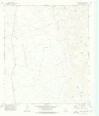
1973 Map of Bitter Well Mountain SW
USGS Topo · Published 1976About this map
The Sierra Diablo mountains dominate the southern portion of this West Texas landscape, giving way to a vast Depression to the north. This arid terrain in Hudspeth and Culberson Counties is defined by its water-management features, essential for ranching and survival in the high desert. Scattered across the basin are isolated improvements such as North End Tub, Cotton Well, and Wade Tank. An Indefinite Boundary separates the two counties, while a prominent Pipeline cuts across the northern flats, signaling the industrial infrastructure of the 1970s. The transition from the steep elevation of Apache Can to the level plains of the north illustrates the rugged geological divide of the region.
Find a feature on this map
11 named features on this map. Tap any name to fly to it.
Don’t see what you’re looking for? This feature index may not catch every label — zoom into the map to look around manually.
Map Details
Editions of this 1973 Bitter Well Mountain SW Map
This is the sole edition of this map. No revisions or reprints were ever made.
Other maps of this area

1895 · Sierra Blanca
USGS Topo · 1:125,000

1906 · Van Horn
USGS Topo · 1:125,000

1954 · Van Horn
USGS Topo · 1:250,000

1955 · Black Mountains
USGS Topo · 1:62,500

1958 · Van Horn
USGS Topo · 1:250,000

1973 · Bitter Well Mountain NW
USGS Topo · 1:24,000

1973 · Sneed Mountain NE
USGS Topo · 1:24,000

1973 · Apache Peak
USGS Topo · 1:24,000

1973 · Bitter Well Mountain
USGS Topo · 1:24,000
1973 · Six Bar Ranch
USGS Topo · 1:24,000