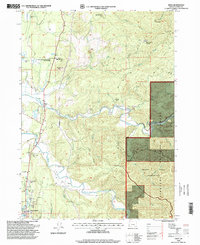
1996 Map of Sixes
USGS Topo · Published 1999About this map
The Sixes River and Elk River systems dominate this coastal Oregon landscape, winding through a region where timber conservation and rugged terrain define the land use. The small settlement of Sixes serves as the primary node of activity, situated near Pacific High School and the protected stands of the Port Orford Cedar Forest State Wayside. To the east, the terrain rises sharply toward Summit Mountain and Eightmile Prairie Mountain, eventually transitioning into the managed lands of the Siskiyou National Forest and the protected Grassy Knob Wilderness.
Find a feature on this map
39 named features on this map. Tap any name to fly to it.
Don’t see what you’re looking for? This feature index may not catch every label — zoom into the map to look around manually.
Map Details
Editions of this 1996 Sixes Map
This is the sole edition of this map. No revisions or reprints were ever made.
Other maps of this area

1899 · Port Orford
USGS Topo · 1:125,000

1903 · Port Orford
USGS Topo · 1:125,000

1954 · Coos Bay
USGS Topo · 1:250,000

1954 · Port Orford
USGS Topo · 1:62,500

1954 · Cape Blanco
USGS Topo · 1:62,500

1954 · Langlois
USGS Topo · 1:62,500

1958 · Coos Bay
USGS Topo · 1:250,000

1962 · Coos Bay
USGS Topo · 1:250,000
1985 · Calf Ranch Mtn
USGS Topo · 1:24,000
1986 · Langlois
USGS Topo · 1:24,000