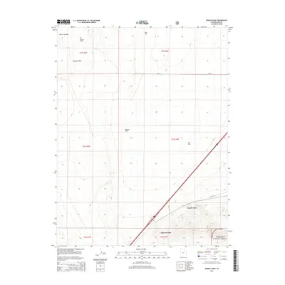
2014 Map of Sixmile Point
USGS Topo · Published 2014About this map
Pahvant Valley dominates this 2014 survey of the eastern Great Basin, where the stark transition from the arid valley floor to the foothills of the Fishlake National Forest is clearly delineated. The map highlights a landscape shaped by geothermal activity and seasonal hydrology, notably featuring Hot Springs in the northeast and the drainage of Dry Wash. Prominent topographic markers such as Hole-in-the-Rock and Beaver Ridge provide essential orientation in an area where the human footprint is primarily defined by the grid of the Public Land Survey System and sparse infrastructure like Sandhills Rd. Topographic points along the mountain interface, including Sixmile Point, Eightmile Point, and Telegraph Point, trace the historic path of travel and surveying along the valley edge.
Find a feature on this map
19 named features on this map. Tap any name to fly to it.
Don’t see what you’re looking for? This feature index may not catch every label — zoom into the map to look around manually.
Map Details
Editions of this 2014 Sixmile Point Map
This is the sole edition of this map. No revisions or reprints were ever made.
Other maps of this area

1885 · Beaver
USGS Topo · 1:250,000

1932 · Sevier
USGS Topo · 1:62,500

1935 · Sevier
USGS Topo · 1:62,500

1953 · Richfield
USGS Topo · 1:250,000

1958 · Richfield
USGS Topo · 1:250,000

1960 · Meadow
USGS Topo · 1:24,000

1962 · Fillmore
USGS Topo · 1:62,500

1962 · Tabernacle Hill
USGS Topo · 1:62,500

1962 · Cove Fort
USGS Topo · 1:62,500

1980 · Richfield
USGS Topo · 1:100,000