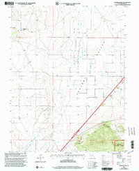
2001 Map of Sixmile Point
USGS Topo · Published 2003About this map
Pahvant Valley serves as a stark agricultural and desert landscape in this Millard County survey, where water management is the primary driver of human activity. The map reveals an extensive network of irrigation through numerous Wells and a system of labeled Ditch lines, illustrating the effort to cultivate the arid flats beneath the rising terrain of Beaver Ridge and Black Ridge. The southern edge of the sheet transitions into the protected highlands of the Fishlake National Forest, where the topography steepens significantly near Eightmile Point and the namesake Sixmile Point. Local industry and infrastructure are represented by several Gravel Pit locations and a modern Rest Area along the highway, while natural water features like Hot Springs and a prominent Dry Wash mark the valley's drainage patterns.
Find a feature on this map
16 named features on this map. Tap any name to fly to it.
Don’t see what you’re looking for? This feature index may not catch every label — zoom into the map to look around manually.
Map Details
Editions of this 2001 Sixmile Point Map
This is the sole edition of this map. No revisions or reprints were ever made.
Other maps of this area

1885 · Beaver
USGS Topo · 1:250,000

1932 · Sevier
USGS Topo · 1:62,500

1935 · Sevier
USGS Topo · 1:62,500

1953 · Richfield
USGS Topo · 1:250,000

1958 · Richfield
USGS Topo · 1:250,000

1960 · Meadow
USGS Topo · 1:24,000

1962 · Fillmore
USGS Topo · 1:62,500

1962 · Tabernacle Hill
USGS Topo · 1:62,500

1962 · Cove Fort
USGS Topo · 1:62,500

1980 · Richfield
USGS Topo · 1:100,000