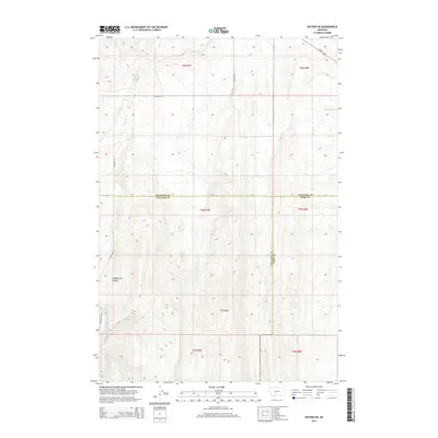
2014 Map of Sixteen NE
USGS Topo · Published 2014About this map
Middle Fork Sixteenmile Cr cuts through the high-elevation terrain of the Bridger and Crazy Mountains transition, a landscape defined by sharp elevation shifts and remote drainage systems. The water follows the deep incision of Middle Fork Canyon in the southwestern portion of the map, while the broad, elevated expanse of Elk Ridge dominates the south-central territory. This 2014 survey documents the convergence of three major Montana counties—Gallatin, Meagher, and Park—capturing a sparsely settled region where ranch roads like Maudlow Rd and Sixteen Mile Rd provide the primary access to the backcountry. In the northeast corner, a short stretch of Us-89 skims the boundary, marking the only paved artery in an otherwise rugged network of seasonal creeks like Meadow Cr and Lost Cr.
Find a feature on this map
18 named features on this map. Tap any name to fly to it.
Don’t see what you’re looking for? This feature index may not catch every label — zoom into the map to look around manually.
Map Details
Editions of this 2014 Sixteen NE Map
This is the sole edition of this map. No revisions or reprints were ever made.
Other maps of this area

1886 · Little Belt Mts.
USGS Topo · 1:250,000

1894 · Little Belt Mts.
USGS Topo · 1:250,000

1897 · Little Belt Mts.
USGS Topo · 1:250,000

1898 · Little Belt Mts.
USGS Topo · 1:250,000

1902 · Little Belt Mts.
USGS Topo · 1:250,000

1948 · White Sulphur Springs
USGS Topo · 1:250,000

1948 · Sixteen
USGS Topo · 1:24,000

1951 · Sixteen NE
USGS Topo · 1:24,000
1951 · Wallrock
USGS Topo · 1:24,000

1951 · Hamen
USGS Topo · 1:24,000