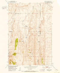
1951 Map of Sixteen NE
USGS Topo · Published 1952About this map
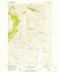
The high ranching country of central Montana, where Meagher, Gallatin, and Park counties converge, is documented here during a period of post-war agricultural transition. The landscape is defined by the prominent Elk Ridge and the complex drainage of the Middle Fork Sixteenmile Creek and Lost Creek. While Campbell Ranch and Potter Ranch remained active hubs of local industry during this 1951 field check, the map records a significant pattern of homestead desertion. Multiple family-named sites are noted as defunct, including Heath Ranch, Sunnyside Ranch, and McMurdo Ranch. This shift is further underscored by the presence of an Oil Well on the southern slopes of Elk Ridge, suggesting a brief period of mineral exploration that had already passed by the time of the survey. The Bureau of Reclamation's involvement in the mapping reflects the era's focus on the development of the Missouri River Basin and the management of high-altitude water resources like Meadow Creek.
Find a feature on this map
13 named features on this map. Tap any name to fly to it.
Don’t see what you’re looking for? This feature index may not catch every label — zoom into the map to look around manually.
Map Details
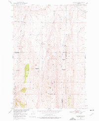
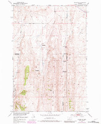
Editions of this 1951 Sixteen NE Map
3 editions found
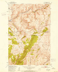
Other maps of this area

1886 · Little Belt Mts.
USGS Topo · 1:250,000

1894 · Little Belt Mts.
USGS Topo · 1:250,000

1897 · Little Belt Mts.
USGS Topo · 1:250,000

1898 · Little Belt Mts.
USGS Topo · 1:250,000

1902 · Little Belt Mts.
USGS Topo · 1:250,000

1948 · White Sulphur Springs
USGS Topo · 1:250,000
1948 · Sixteen
USGS Topo · 1:24,000
1951 · Wallrock
USGS Topo · 1:24,000
1951 · Hamen
USGS Topo · 1:24,000
1951 · Wolf Hill
USGS Topo · 1:24,000