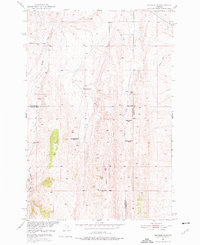
1951 Map of Sixteen NE
USGS Topo · Published 1976About this map
Elk Ridge dominates the central landscape of this Montana survey, where three county lines—Meagher, Gallatin, and Park—converge in a high-elevation ranching district. The mapping reveals a transition in land use during the mid-century, specifically noted through several isolated ranching operations such as Campbell Ranch and Potter Ranch. The presence of multiple decommissioned sites, including Sunnyside Ranch (Aban'd), Heath Ranch (Aban'd), and McMurdo Ranch (Aban'd), suggests a consolidation or shift in the local livestock economy. Water sources like the Middle Fork Sixteenmile Creek and Lost Creek are the primary landmarks in this territory. Beyond ranching, evidence of early industrial exploration appears via an Oil Well (Aban'd) south of the ridge. The road network is sparse, centered on the Meadow Creek Road providing access to the western drainage of Meadow Creek.
Find a feature on this map
14 named features on this map. Tap any name to fly to it.
Don’t see what you’re looking for? This feature index may not catch every label — zoom into the map to look around manually.
Map Details
Editions of this 1951 Sixteen NE Map
3 editions found
Other maps of this area

1886 · Little Belt Mts.
USGS Topo · 1:250,000

1894 · Little Belt Mts.
USGS Topo · 1:250,000

1897 · Little Belt Mts.
USGS Topo · 1:250,000

1898 · Little Belt Mts.
USGS Topo · 1:250,000

1902 · Little Belt Mts.
USGS Topo · 1:250,000

1948 · White Sulphur Springs
USGS Topo · 1:250,000

1948 · Sixteen
USGS Topo · 1:24,000

1951 · Sixteen NE
USGS Topo · 1:24,000
1951 · Wallrock
USGS Topo · 1:24,000

1951 · Hamen
USGS Topo · 1:24,000