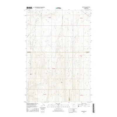
2017 Map of Sixteen NE
USGS Topo · Published 2017About this map
Middle Fork Sixteenmile Cr carves through the southern reaches of this Montana landscape, where the high-elevation drainage of Middle Fork Canyon defines the local topography. This 2017 survey captures a remote intersection of Gallatin County, Meagher County, and Park County, an area characterized by significant elevation changes and seasonal watercourses. The map traces the winding paths of Meadow Cr, Lost Cr, and Potter Cr as they descend from prominent features like Elk Ridge. This is a landscape of large-scale land management and natural boundaries, where access is provided by a network of rural routes including Meadow Creek Rd and Sixteen Mile Creek Rd. The absence of developed townsites highlights the primary use of this land for ranching or forestry at the headwaters of the regional watershed.
Find a feature on this map
20 named features on this map. Tap any name to fly to it.
Don’t see what you’re looking for? This feature index may not catch every label — zoom into the map to look around manually.
Map Details
Editions of this 2017 Sixteen NE Map
This is the sole edition of this map. No revisions or reprints were ever made.
Other maps of this area

1886 · Little Belt Mts.
USGS Topo · 1:250,000

1894 · Little Belt Mts.
USGS Topo · 1:250,000

1897 · Little Belt Mts.
USGS Topo · 1:250,000

1898 · Little Belt Mts.
USGS Topo · 1:250,000

1902 · Little Belt Mts.
USGS Topo · 1:250,000

1948 · White Sulphur Springs
USGS Topo · 1:250,000

1948 · Sixteen
USGS Topo · 1:24,000

1951 · Sixteen NE
USGS Topo · 1:24,000
1951 · Wallrock
USGS Topo · 1:24,000

1951 · Hamen
USGS Topo · 1:24,000