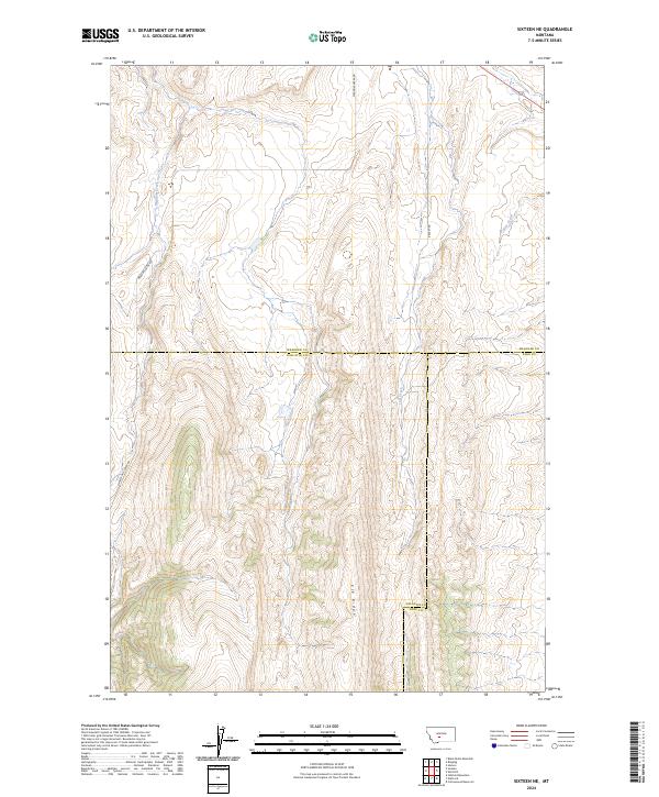
2024 Map of Sixteen NE
USGS Topo · Published 2024About this map
The high Montana backcountry where Meagher, Gallatin, and Park counties converge is defined by the prominent spine of Elk Ridge. This 2024 survey captures a landscape of steep drainage basins and narrow riparian corridors, where Meadow Creek and Lost Creek carve through the mountain terrain. Settlement is sparse in this portion of the Sixteen NE quadrangle, with the human footprint primarily restricted to remote access routes such as Meadow Creek Rd and Sixteen Mile Creek Rd. The map provides a clear look at the complex political geography of the region, specifically where the county lines of Meagher, Gallatin, and Park counties intersect. Further east, Potter Creek flows through the upper reaches of the drainage, while Brekey Rd tracks along the high ridges, serving as a vital link in this lightly inhabited territory.
Find a feature on this map
16 named features on this map. Tap any name to fly to it.
Don’t see what you’re looking for? This feature index may not catch every label — zoom into the map to look around manually.
Map Details
Editions of this 2024 Sixteen NE Map
This is the sole edition of this map. No revisions or reprints were ever made.
Other maps of this area

1886 · Little Belt Mts.
USGS Topo · 1:250,000

1894 · Little Belt Mts.
USGS Topo · 1:250,000

1897 · Little Belt Mts.
USGS Topo · 1:250,000

1898 · Little Belt Mts.
USGS Topo · 1:250,000

1902 · Little Belt Mts.
USGS Topo · 1:250,000

1948 · White Sulphur Springs
USGS Topo · 1:250,000

1948 · Sixteen
USGS Topo · 1:24,000

1951 · Sixteen NE
USGS Topo · 1:24,000
1951 · Wallrock
USGS Topo · 1:24,000

1951 · Hamen
USGS Topo · 1:24,000