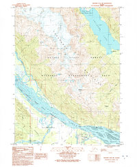
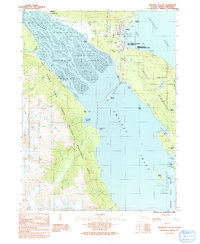
1991 Map of Skagway B-2 SW
USGS Topo · Published 1991About this map
The Takshanuuk Mountains dominate this 1991 survey of the Alaskan panhandle, rising sharply between the massive drainage of the Chilkat River and the depths of Chilkoot Lake. This landscape is defined by its conservation status, containing large portions of the Alaska Chilkat Bald Eagle Preserve (State) and the Haines State Forest Resource Management Area. These designations reflect the area's ecological significance, particularly the river flats that support world-renowned eagle populations.
Find a feature on this map
18 named features on this map. Tap any name to fly to it.
Don’t see what you’re looking for? This feature index may not catch every label — zoom into the map to look around manually.
Map Details
Editions of this 1991 Skagway B-2 SW Map
This is the sole edition of this map. No revisions or reprints were ever made.
Other maps of this area

1952 · Skagway
USGS Topo · 1:250,000

1954 · Skagway B-2
USGS Topo · 1:63,360

1954 · Skagway A-3
USGS Topo · 1:63,360

1954 · Skagway A-2
USGS Topo · 1:63,360

1954 · Skagway B-3
USGS Topo · 1:63,360

1961 · Skagway
USGS Topo · 1:250,000
1991 · Skagway B-3 NE
USGS Topo · 1:25,000
1991 · Skagway B-2 SE
USGS Topo · 1:25,000
1991 · Skagway B-3 SE
USGS Topo · 1:25,000
1991 · Skagway A-2 NE
USGS Topo · 1:25,000