
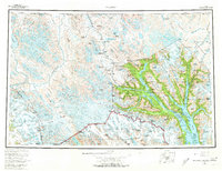
1961 Map of Skagway
USGS Topo · Published 1967About this map
Skagway and Haines serve as the primary coastal gateways in this mid-century portrait of the Upper Lynn Canal region. The landscape is defined by the heavy presence of industrial and historical transit corridors, notably the White Pass and Yukon Railway winding north and the storied Chilkoot Trail leading toward the Canadian border. To the west, the massive ice fields of the Saint Elias Mountains feed numerous glaciers, including the Grand Pacific Glacier and Margerie Glacier within the Glacier Bay National Monument.
Find a feature on this map
131 named features on this map. Tap any name to fly to it.
Don’t see what you’re looking for? This feature index may not catch every label — zoom into the map to look around manually.
Map Details
Editions of this 1961 Skagway Map
4 editions found
Other maps of this area

1948 · Skagway C-4
USGS Topo · 1:63,360

1948 · Skagway C-3
USGS Topo · 1:63,360

1948 · Mount Fairweather D-1
USGS Topo · 1:63,360

1948 · Juneau D-3
USGS Topo · 1:63,360

1948 · Skagway C-2
USGS Topo · 1:63,360

1948 · Skagway A-1
USGS Topo · 1:63,360

1948 · Mount Fairweather D-2
USGS Topo · 1:63,360

1948 · Skagway C-1
USGS Topo · 1:63,360

1949 · Atlin
USGS Topo · 1:250,000

1949 · Juneau D-6
USGS Topo · 1:63,360