
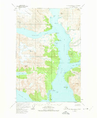
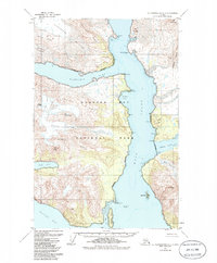
1948 Map of Mount Fairweather D-1
USGS Topo · Published 1963About this map
Glacier Bay National Monument dominates this mid-century survey, revealing a landscape defined by retreating ice and advancing waterways. The glacial network is highly active, with the massive Muir Glacier at the north feeding into the expanding Muir Inlet. The map documents numerous ice fields including the Burroughs Glacier, Idaho Glacier, and Casement Glacier, which carve through high-elevation features like Minnesota Ridge and Mt Kloh Kutz. This 1948 topography, based on aerial photography, captures the exact state of the inlets and ice fronts before further decades of warming. Coastal features such as Sebree Island and the Caroline Shoal at the southern end of the inlet provide essential markers for understanding the shifting shoreline and maritime navigation within the bay.
Find a feature on this map
38 named features on this map. Tap any name to fly to it.
Don’t see what you’re looking for? This feature index may not catch every label — zoom into the map to look around manually.
Map Details
Editions of this 1948 Mount Fairweather D-1 Map
3 editions found
Other maps of this area

1948 · Juneau C-6
USGS Topo · 1:63,360

1948 · Mount Fairweather D-2
USGS Topo · 1:63,360

1948 · Mount Fairweather C-1
USGS Topo · 1:63,360

1948 · Mount Fairweather C-2
USGS Topo · 1:63,360

1949 · Mount Fairweather C-1
USGS Topo · 1:63,360

1949 · Juneau D-6
USGS Topo · 1:63,360

1950 · Mount Fairweather D-2
USGS Topo · 1:63,360

1950 · Mount Fairweather C-2
USGS Topo · 1:63,360

1950 · Juneau C-6
USGS Topo · 1:63,360

1951 · Juneau
USGS Topo · 1:250,000