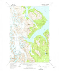
1948 Map of Mount Fairweather C-2
USGS Topo · Published 1975About this map
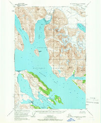
Glacier Bay National Monument preserves a complex maritime and glacial landscape in the late 1940s, a period after initial exploration but before the era of modern tourism. The map detail reflects the active ice movement and hydrologic systems of the era, defined by the deep waters of Charpentier Inlet and Geikie Inlet. These inlets are fed by massive ice flows including the Charpentier Glacier and Geikie Glacier, which carved the surrounding peaks such as Hugh Miller Mountain and Mt Favorite. Inland, isolated water bodies like Abyss Lake and Lake Seclusion are caught between the ice and high ridges, illustrating the transition between the glaciated high country and the coastal fjords. Local peaks like Tlingit Peak and Serrated Peak serve as primary landmarks for navigation along this intricate shoreline, where the lack of roads or established trails highlights the wilderness character of the monument during this mid-century survey.
Find a feature on this map
30 named features on this map. Tap any name to fly to it.
Don’t see what you’re looking for? This feature index may not catch every label — zoom into the map to look around manually.
Map Details
Editions of this 1948 Mount Fairweather C-2 Map
2 editions found

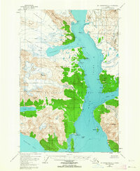
Other maps of this area
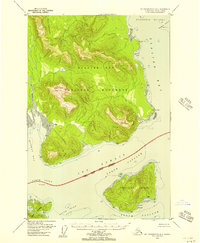
1948 · Mount Fairweather B-1
USGS Topo · 1:63,360
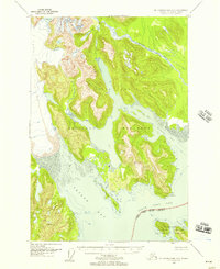
1948 · Mount Fairweather B-2
USGS Topo · 1:63,360
1948 · Mount Fairweather D-1
USGS Topo · 1:63,360
1948 · Mount Fairweather D-2
USGS Topo · 1:63,360

1948 · Mount Fairweather C-1
USGS Topo · 1:63,360

1949 · Mount Fairweather C-1
USGS Topo · 1:63,360

1950 · Mount Fairweather D-2
USGS Topo · 1:63,360

1950 · Mount Fairweather C-2
USGS Topo · 1:63,360
1951 · Mt Fairweather
USGS Topo · 1:250,000

1954 · Mount Fairweather D-1
USGS Topo · 1:63,360