
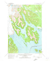
1948 Map of Mount Fairweather B-2
USGS Topo · Published 1957About this map
Glacier Bay National Monument and the southeastern edge of the Tongass National Forest dominate this coastal Alaskan landscape, recorded here just after the mid-century. The map captures a wilderness in transition, characterized by the massive expanse of the Brady Glacier and the precarious ice-dammed waters of Abyss Lake, which is noted near a field of Crevasses.
Find a feature on this map
22 named features on this map. Tap any name to fly to it.
Don’t see what you’re looking for? This feature index may not catch every label — zoom into the map to look around manually.
Map Details
Editions of this 1948 Mount Fairweather B-2 Map
2 editions found
Other maps of this area

1948 · Mount Fairweather A-2
USGS Topo · 1:63,360

1948 · Mount Fairweather B-1
USGS Topo · 1:63,360

1948 · Mount Fairweather A-1
USGS Topo · 1:63,360

1948 · Mount Fairweather C-1
USGS Topo · 1:63,360

1948 · Mount Fairweather C-2
USGS Topo · 1:63,360

1949 · Mount Fairweather C-1
USGS Topo · 1:63,360

1950 · Mount Fairweather C-2
USGS Topo · 1:63,360

1951 · Mt Fairweather
USGS Topo · 1:250,000

1954 · Mount Fairweather A-1
USGS Topo · 1:63,360
1961 · Mount Fairweather A-3
USGS Topo · 1:63,360