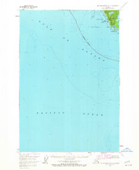
1961 Map of Mount Fairweather A-3
USGS Topo · Published 1965About this map
The Glacier Bay National Monument shoreline and the open waters of the Gulf of Alaska dominate this mid-century survey. While much of the sheet covers the deep soundings of the Pacific Ocean, the northeastern corner captures the complex coastal geography where the monument boundary meets the sea. Landforms such as Polka Peninsula and the prominent Point Villaluenga mark the entrance to Glacier Bay, providing a clear record of the coastline as it appeared in the early 1960s. The map also identifies navigational hazards including Graves Rocks and Polka Rk, alongside an Indefinite Boundary that speaks to the ongoing maritime and territorial surveying efforts of the era. This chart is a specific intersection of conservation history and nautical charting, documenting the remote perimeter of one of Alaska's most significant protected wilderness areas.
Find a feature on this map
10 named features on this map. Tap any name to fly to it.
Don’t see what you’re looking for? This feature index may not catch every label — zoom into the map to look around manually.
Map Details
Editions of this 1961 Mount Fairweather A-3 Map
2 editions found
Other maps of this area

1948 · Mount Fairweather A-2
USGS Topo · 1:63,360

1948 · Mount Fairweather B-2
USGS Topo · 1:63,360

1948 · Sitka D-8
USGS Topo · 1:63,360

1950 · Sitka D-8
USGS Topo · 1:63,360

1951 · Mt Fairweather
USGS Topo · 1:250,000

1951 · Sitka
USGS Topo · 1:250,000

1952 · Sitka
USGS Topo · 1:250,000
1961 · Mount Fairweather B-3
USGS Topo · 1:63,360
1961 · Mt Fairweather B-4
USGS Topo · 1:63,360

1961 · Mt Fairweather
USGS Topo · 1:250,000