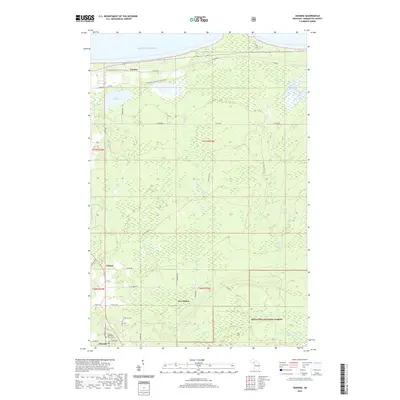
2019 Map of Skandia
USGS Topo · Published 2019About this map
The southern shore of Lake Superior defines the northern edge of this Upper Peninsula landscape, where water and woodland dictate the pattern of settlement. Smaller communities like Skandia, Yalmar, and New Dalton are linked by a network of county roads and historic trails, including the N Country National Scenic Trail which winds through the northern sections near Gordon. The terrain is deeply hydrological, featuring the Chocolay River, Sand River, and the James D Jeske Flooding area.
Find a feature on this map
46 named features on this map. Tap any name to fly to it.
Don’t see what you’re looking for? This feature index may not catch every label — zoom into the map to look around manually.
Map Details
Editions of this 2019 Skandia Map
This is the sole edition of this map. No revisions or reprints were ever made.
Other maps of this area

1907 · Marquette
USGS Topo · 1:62,500

1932 · Skandia SW
USGS Topo · 1:31,680

1932 · Skandia SE
USGS Topo · 1:31,680

1932 · Skandia NE
USGS Topo · 1:31,680

1932 · Harvey SE
USGS Topo · 1:31,680

1932 · Harvey NE
USGS Topo · 1:31,680

1950 · Skandia NW
USGS Topo · 1:31,680

1952 · Gwinn
USGS Topo · 1:62,500

1954 · Marquette
USGS Topo · 1:62,500

1958 · Laughing Fish Point
USGS Topo · 1:62,500