
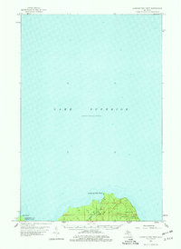
1958 Map of Laughing Fish Point
USGS Topo · Published 1959About this map
Lake Superior dominates this mid-century hydrographic and topographic study, where the Upper Peninsula coastline forms a sharp transition between the deep waters of the Great Lakes and the dense woodlands of the Hiawatha National Forest. The map centers on the distinctive geographic features of Laughing Fish Point and Shot Point, capturing the rugged northern shore before modern development altered the remote character of Alger Co and Marquette Co.
Find a feature on this map
9 named features on this map. Tap any name to fly to it.
Don’t see what you’re looking for? This feature index may not catch every label — zoom into the map to look around manually.
Map Details
Editions of this 1958 Laughing Fish Point Map
2 editions found
Other maps of this area

1932 · Skandia NE
USGS Topo · 1:31,680

1950 · Skandia NW
USGS Topo · 1:31,680

1958 · Au Train
USGS Topo · 1:62,500

1958 · Skandia
USGS Topo · 1:62,500

1958 · Marquette
USGS Topo · 1:250,000

1960 · Marquette
USGS Topo · 1:250,000

1961 · Marquette
USGS Topo · 1:250,000

1968 · Marquette
USGS Topo · 1:250,000
1983 · Gwinn
USGS Topo · 1:100,000

1983 · Munising
USGS Topo · 1:100,000