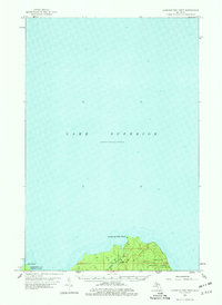
1958 Map of Laughing Fish Point
USGS Topo · Published 1978About this map
Lake Superior dominates this mid-century survey, defining the rugged northern coastline of Michigan's Upper Peninsula. The land area is concentrated along the southern edge of the sheet, where the prominent Laughing Fish Point and Shot Point reach into the cold waters. Much of this shoreline remains undeveloped and protected within the Hiawatha National Forest, showcasing a landscape of dense woods and northern drainages. The Laughing Whitefish R flows through the center of the landmass, crossing the border between Alger Co and Marquette Co. The map captures a moment in the late 1950s when this remote section of Chocolay Twp was characterized by its natural features and forestry boundaries rather than human settlement, offering a clear view of the pristine Lake Superior frontage before modern coastal development.
Find a feature on this map
8 named features on this map. Tap any name to fly to it.
Don’t see what you’re looking for? This feature index may not catch every label — zoom into the map to look around manually.
Map Details
Editions of this 1958 Laughing Fish Point Map
2 editions found
Other maps of this area

1932 · Skandia NE
USGS Topo · 1:31,680

1950 · Skandia NW
USGS Topo · 1:31,680

1958 · Au Train
USGS Topo · 1:62,500

1958 · Laughing Fish Point
USGS Topo · 1:62,500

1958 · Skandia
USGS Topo · 1:62,500

1958 · Marquette
USGS Topo · 1:250,000

1960 · Marquette
USGS Topo · 1:250,000

1961 · Marquette
USGS Topo · 1:250,000

1968 · Marquette
USGS Topo · 1:250,000
1983 · Gwinn
USGS Topo · 1:100,000