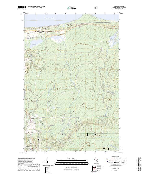
2023 Map of Skandia
USGS Topo · Published 2023About this map
Skandia and its surrounding Upper Peninsula timberlands are defined by a network of drainage systems flowing toward Lake Superior. This modern topography documents the rural character of Marquette County, where small settlements like Yalmar and New Dalton are interspersed among significant water features such as Lake Kawbawgam and the James Jeske Flooding. The landscape is etched with historical routes and modern recreation, including the North Country National Scenic Trl and the Marquette-manistique Route Trl, which traverse the northern reaches of the Hiawatha National Forest. Local history is anchored by sites like the United Methodist Church Cem and Haglund Cem. The map illustrates a complex riparian environment where the Laughing Whitefish River, Sand River, and Chocolay River headwaters converge, shaping the terrain's transition from forest to lakefront.
Find a feature on this map
45 named features on this map. Tap any name to fly to it.
Don’t see what you’re looking for? This feature index may not catch every label — zoom into the map to look around manually.
Map Details
Editions of this 2023 Skandia Map
This is the sole edition of this map. No revisions or reprints were ever made.
Other maps of this area

1907 · Marquette
USGS Topo · 1:62,500

1932 · Skandia SW
USGS Topo · 1:31,680

1932 · Skandia SE
USGS Topo · 1:31,680

1932 · Skandia NE
USGS Topo · 1:31,680

1932 · Harvey SE
USGS Topo · 1:31,680

1932 · Harvey NE
USGS Topo · 1:31,680

1950 · Skandia NW
USGS Topo · 1:31,680

1952 · Gwinn
USGS Topo · 1:62,500

1954 · Marquette
USGS Topo · 1:62,500

1958 · Laughing Fish Point
USGS Topo · 1:62,500