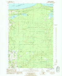
1985 Map of Skandia
USGS Topo · Published 1985About this map
Upper Peninsula timberlands and small Marquette County settlements define this 1985 survey, showing the landscape as it appeared just before the mid-1980s. The community of Skandia and the nearby Skandia Station serve as focal points for local history, alongside Yalmar and the smaller New Dalton. A legacy of the region's industrial past is visible in the Old Railroad Grade that cuts through the Escanaba River State Forest, tracing a path near Lake Le Vasseur. Cultural landmarks like the Country Chapel and Haglund Cem offer specific touchpoints for genealogical research. The northern edge of the map meets Lake Superior, where the James D Jeske Flooding and Laughing Whitefish River highlight the drainage patterns of the coastal forests. Large tracts of the Upper Peninsula Experimental Forest suggest the area's continued importance for forestry and land management during this era.
Find a feature on this map
38 named features on this map. Tap any name to fly to it.
Don’t see what you’re looking for? This feature index may not catch every label — zoom into the map to look around manually.
Map Details
Editions of this 1985 Skandia Map
This is the sole edition of this map. No revisions or reprints were ever made.
Other maps of this area

1907 · Marquette
USGS Topo · 1:62,500

1932 · Skandia SW
USGS Topo · 1:31,680

1932 · Skandia SE
USGS Topo · 1:31,680

1932 · Skandia NE
USGS Topo · 1:31,680

1932 · Harvey SE
USGS Topo · 1:31,680

1932 · Harvey NE
USGS Topo · 1:31,680

1950 · Skandia NW
USGS Topo · 1:31,680

1952 · Gwinn
USGS Topo · 1:62,500

1954 · Marquette
USGS Topo · 1:62,500

1958 · Laughing Fish Point
USGS Topo · 1:62,500