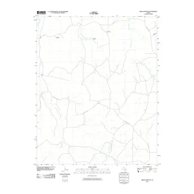
2010 Map of Skellytown NE
USGS Topo · Published 2010About this map
Price Ranch and Hayhook Ranch anchor this landscape of the Texas Panhandle, where the cattle industry has long defined the geography. The terrain is deeply incised by the drainage systems of White Deer Creek and Reynolds Creek, which create a complex network of seasonal draws across the plains. Human presence is sparse, centered on these large ranch holdings and auxiliary sites like West Camp.
Find a feature on this map
16 named features on this map. Tap any name to fly to it.
Don’t see what you’re looking for? This feature index may not catch every label — zoom into the map to look around manually.
Map Details
Editions of this 2010 Skellytown NE Map
This is the sole edition of this map. No revisions or reprints were ever made.
Other maps of this area

1954 · Amarillo
USGS Topo · 1:250,000

1958 · Amarillo
USGS Topo · 1:250,000

1963 · Pampa
USGS Topo · 1:24,000

1963 · Skellytown
USGS Topo · 1:24,000

1965 · Lake Mc Connell
USGS Topo · 1:24,000

1971 · Skellytown NW
USGS Topo · 1:24,000

1971 · Dry Creek South
USGS Topo · 1:24,000

1971 · Skellytown NE
USGS Topo · 1:24,000

1971 · Adobe Creek SW
USGS Topo · 1:24,000

1971 · Pampa NW
USGS Topo · 1:24,000