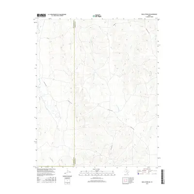
2016 Map of Skellytown NE
USGS Topo · Published 2016About this map
White Deer Springs and the perennial drainage of White Deer Cr define the western reaches of this High Plains landscape along the border of Hutchinson and Roberts counties. The terrain is characterized by a network of deeply incised draws and ephemeral watercourses, most notably W Fork Reynolds Cr and Reynolds Cr, which drain the eastern portion of the quadrangle toward the Canadian River basin. A sparse network of ranching infrastructure, including N Price Ranch Rd, S Price Ranch Rd, and Morrison Ranch Rd, underscores the region's enduring focus on large-scale cattle operations. The map provides a clear look at the topographic contours of these breaks, where the flat plains drop away into a complex system of ridges and valleys that have dictated the placement of roads and homesteads for generations.
Find a feature on this map
11 named features on this map. Tap any name to fly to it.
Don’t see what you’re looking for? This feature index may not catch every label — zoom into the map to look around manually.
Map Details
Editions of this 2016 Skellytown NE Map
This is the sole edition of this map. No revisions or reprints were ever made.
Other maps of this area

1954 · Amarillo
USGS Topo · 1:250,000

1958 · Amarillo
USGS Topo · 1:250,000

1963 · Pampa
USGS Topo · 1:24,000

1963 · Skellytown
USGS Topo · 1:24,000

1965 · Lake Mc Connell
USGS Topo · 1:24,000

1971 · Skellytown NW
USGS Topo · 1:24,000

1971 · Dry Creek South
USGS Topo · 1:24,000

1971 · Skellytown NE
USGS Topo · 1:24,000

1971 · Adobe Creek SW
USGS Topo · 1:24,000

1971 · Pampa NW
USGS Topo · 1:24,000