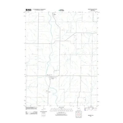
2012 Map of Skidmore
USGS Topo · Published 2012About this map
The Nodaway River winds through this Northwest Missouri landscape, anchoring the small settlements of Skidmore and Quitman. The area is defined by a dense network of watercourses, including Sand Creek, Florida Creek, and Hickory Creek, which flow through a grid of rural roads and agricultural lands. For local historians and genealogists, the map identifies several significant burial grounds clustered near the primary settlement, such as the Masonic Cemetery, Smith Cemetery, Hillcrest Cemetery, and the Skidmore Cemetery. The layout of the land reflects a traditional Midwestern township structure, with named routes like Colony Rd and Catalina Rd connecting outlying farms to the river valley hubs. The presence of numerous named branches and creeks like Bowman Branch and Bagby Creek illustrates the intricate drainage system that has historically shaped the region's farming and settlement patterns.
Find a feature on this map
45 named features on this map. Tap any name to fly to it.
Don’t see what you’re looking for? This feature index may not catch every label — zoom into the map to look around manually.
Map Details
Editions of this 2012 Skidmore Map
This is the sole edition of this map. No revisions or reprints were ever made.
Other maps of this area

1926 · Maitland
USGS Topo · 1:62,500

1927 · Bolckow
USGS Topo · 1:62,500

1939 · Skidmore
USGS Topo · 1:62,500

1941 · Skidmore
USGS Topo · 1:62,500

1942 · Skidmore
USGS Topo · 1:62,500

1943 · Maryville
USGS Topo · 1:62,500

1945 · Bolckow
USGS Topo · 1:62,500

1955 · Nebraska City
USGS Topo · 1:250,000

1957 · Nebraska City
USGS Topo · 1:250,000

1958 · Nebraska City
USGS Topo · 1:250,000