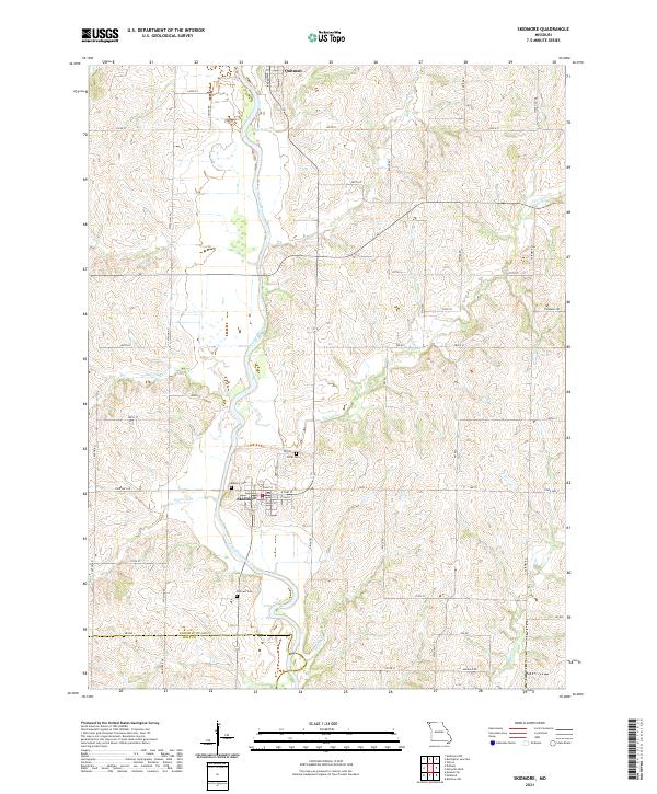
2021 Map of Skidmore
USGS Topo · Published 2021About this map
The Nodaway River winds through this agricultural landscape on the border of Nodaway Co and Holt Co, defining the drainage patterns for numerous local tributaries. The town of Skidmore serves as a central hub for the surrounding rural area, featuring a grid of residential streets like E Elm St and E Oak St. For those tracing local genealogy or community history, the map identifies several significant burial sites including Hillcrest Cem south of town, Masonic Cem to the west, and Smith Cem to the north. North of Skidmore, the smaller settlement of Quitman sits near the river, connected by a network of rural routes such as Colony Rd and Broadway St. Numerous named creeks, including Florida Cr and Hickory Cr, carve through the rolling terrain, illustrating the hydrologic network that has long supported the region's farms.
Find a feature on this map
57 named features on this map. Tap any name to fly to it.
Don’t see what you’re looking for? This feature index may not catch every label — zoom into the map to look around manually.
Map Details
Editions of this 2021 Skidmore Map
This is the sole edition of this map. No revisions or reprints were ever made.
Other maps of this area

1926 · Maitland
USGS Topo · 1:62,500

1927 · Bolckow
USGS Topo · 1:62,500

1939 · Skidmore
USGS Topo · 1:62,500

1941 · Skidmore
USGS Topo · 1:62,500

1942 · Skidmore
USGS Topo · 1:62,500

1943 · Maryville
USGS Topo · 1:62,500

1945 · Bolckow
USGS Topo · 1:62,500

1955 · Nebraska City
USGS Topo · 1:250,000

1957 · Nebraska City
USGS Topo · 1:250,000

1958 · Nebraska City
USGS Topo · 1:250,000