
1966 Map of Skull Lake
USGS Topo · Published 1967About this map
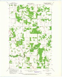
The Canada United States border defines the northern edge of this northern Minnesota landscape, where the marshy terrain of Kittson County meets the Provencher District of Manitoba. At the heart of the sheet lies the expansive St Joseph Skull Lake State Wildlife Management Area, a complex of wetlands and wooded patches surrounding Skull Lake. The low-lying topography is managed by an extensive network of drainage infrastructure, including State Ditch No 84 and State Ditch No 14, which redirect water across the flat plains. In the southern portion of the quadrangle, the North Branch Two Rivers meanders through the townships of Poppleton and Cannon. Evidence of local community life appears in the scattered rural landmarks, from the First Lutheran Ch and the neighboring Townhall to the McKinley Cem located near the small settlement of McKinley.
Find a feature on this map
20 named features on this map. Tap any name to fly to it.
Don’t see what you’re looking for? This feature index may not catch every label — zoom into the map to look around manually.
Map Details
Editions of this 1966 Skull Lake Map
This is the sole edition of this map. No revisions or reprints were ever made.
Other maps of this area

1918 · Hemmington
USGS Topo · 1:62,500

1941 · Hallock
USGS Topo · 1:62,500

1952 · Thief River Falls
USGS Topo · 1:250,000

1956 · Thief River Falls
USGS Topo · 1:250,000

1957 · Thief River Falls
USGS Topo · 1:250,000

1966 · Skull Lake NE
USGS Topo · 1:24,000

1966 · Skull Lake SE
USGS Topo · 1:24,000
1966 · Skull Lake SW
USGS Topo · 1:24,000

1967 · Thief River Falls
USGS Topo · 1:250,000
1974 · Hallock NE
USGS Topo · 1:24,000