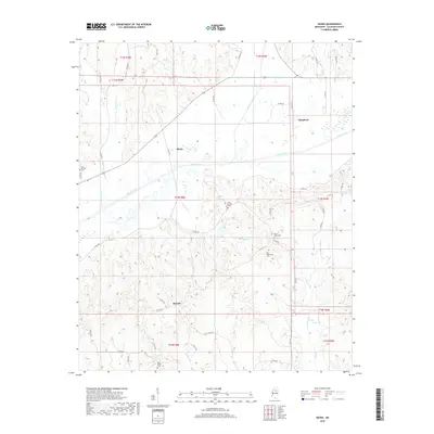
2018 Map of Skuna
USGS Topo · Published 2018About this map
The Skuna River basin in Calhoun County defines this landscape, where the river winds through a broad floodplain between the settlements of Skuna and Shepherd. This 2018 survey illustrates a rural Mississippi environment heavily intersected by a network of county roads, including Co RD 242 and Co RD 247, which connect the scattered homesteads and agricultural tracts. The geography is notable for its numerous family and community burial grounds, such as Zion Springs Cem and Mount Tabor Cem, which serve as vital markers for local genealogical research. To the south, the settlement of Bounds sits near the headwaters of several drainages, including Lickup Cr and Savannah Cr. The map details a sophisticated drainage system where smaller tributaries like Burkes Cr and Persimmon Creek feed into the primary river valley, reflecting the area's enduring reliance on the natural hydrology for land division and transport.
Find a feature on this map
55 named features on this map. Tap any name to fly to it.
Don’t see what you’re looking for? This feature index may not catch every label — zoom into the map to look around manually.
Map Details
Editions of this 2018 Skuna Map
This is the sole edition of this map. No revisions or reprints were ever made.
Other maps of this area

1953 · West Point
USGS Topo · 1:250,000

1954 · Pittsboro
USGS Topo · 1:62,500

1954 · Water Valley
USGS Topo · 1:62,500

1955 · Water Valley
USGS Topo · 1:62,500

1955 · Coffeeville
USGS Topo · 1:62,500

1956 · Tupelo
USGS Topo · 1:250,000

1958 · Tupelo
USGS Topo · 1:250,000

1958 · West Point
USGS Topo · 1:250,000

1963 · West Point
USGS Topo · 1:250,000
1972 · Banner
USGS Topo · 1:24,000