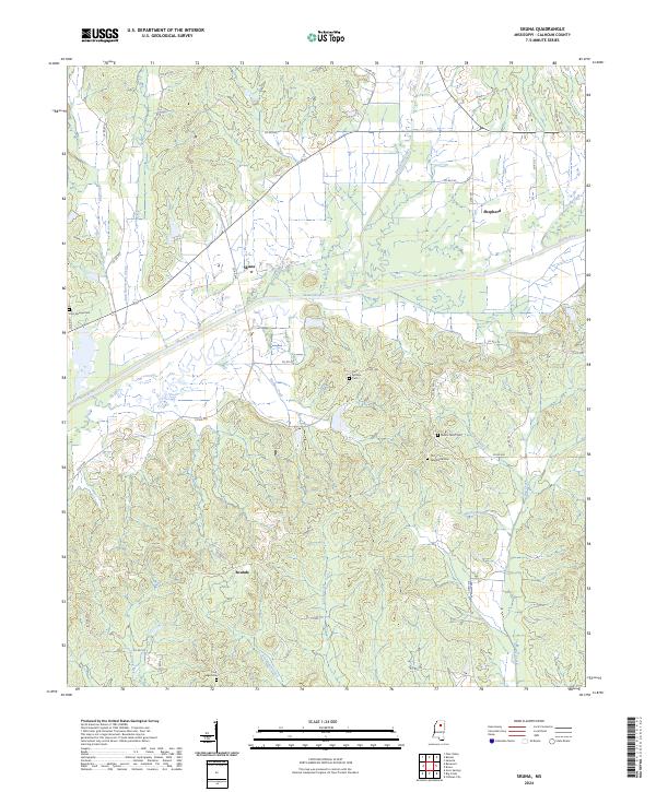
2024 Map of Skuna
USGS Topo · Published 2024About this map
The Skuna River winds through this central Mississippi landscape, defining the topography of the Skuna and Shepherd areas. The drainage network is dense, with Burkes Creek, Lickup Creek, and Savannah Creek feeding the river system from the south. This terrain is characterized by a high concentration of small, family or community burial grounds that often mark the historical centers of rural life. Researchers can find Old Tabernacle Cem and Mount Tabor Cem situated near the headwaters of Foster Creek, while Zion Springs Cem and Clear Springs Cem are located further west. The settlement of Bounds anchors the southern portion of the quadrangle, connected by a network of county roads including Co RD 322 and Co RD 300 that trace the ridges between the numerous creek branches.
Find a feature on this map
54 named features on this map. Tap any name to fly to it.
Don’t see what you’re looking for? This feature index may not catch every label — zoom into the map to look around manually.
Map Details
Editions of this 2024 Skuna Map
This is the sole edition of this map. No revisions or reprints were ever made.
Other maps of this area

1953 · West Point
USGS Topo · 1:250,000

1954 · Pittsboro
USGS Topo · 1:62,500

1954 · Water Valley
USGS Topo · 1:62,500

1955 · Water Valley
USGS Topo · 1:62,500

1955 · Coffeeville
USGS Topo · 1:62,500

1956 · Tupelo
USGS Topo · 1:250,000

1958 · Tupelo
USGS Topo · 1:250,000

1958 · West Point
USGS Topo · 1:250,000

1963 · West Point
USGS Topo · 1:250,000
1972 · Banner
USGS Topo · 1:24,000