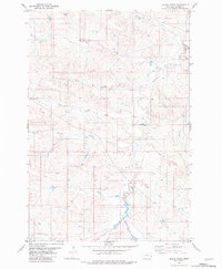
1981 Map of Skunk Creek
USGS Topo · Published 1981About this map
O'Fallon Creek and its many seasonal tributaries define this section of Carter County in the mid-1970s. The landscape is characterized by a dense network of drainages, including Antelope Creek and Buffalo Creek, which reveal the intricate erosional patterns of the northern plains. This 1981 edition, based on earlier aerial photography, captures the remote ranching country of eastern Montana where few permanent structures or roads appear. Notable drainages like Skunk Creek, Hay Creek, and H Seven Creek carve through the terrain, providing essential landmarks in an area of sparse human settlement. The map serves as a detailed record of the natural hydrology and topographical contours before any significant modern land alterations, preserving the original names of local waterways such as Dugout Creek and Alkali Creek.
Find a feature on this map
10 named features on this map. Tap any name to fly to it.
Don’t see what you’re looking for? This feature index may not catch every label — zoom into the map to look around manually.
Map Details
Editions of this 1981 Skunk Creek Map
This is the sole edition of this map. No revisions or reprints were ever made.
Other maps of this area

1953 · Miles City
USGS Topo · 1:250,000

1954 · Ekalaka
USGS Topo · 1:250,000

1956 · Ekalaka
USGS Topo · 1:250,000

1957 · Miles City
USGS Topo · 1:250,000

1958 · Miles City
USGS Topo · 1:250,000

1958 · Ekalaka
USGS Topo · 1:250,000

1965 · Ekalaka
USGS Topo · 1:250,000

1979 · Blacktail Creek NW
USGS Topo · 1:24,000

1979 · Board Corral Creek
USGS Topo · 1:24,000

1979 · Beaver Flats North
USGS Topo · 1:24,000