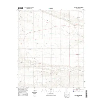
2013 Map of Skute Stone Arroyo
USGS Topo · Published 2013About this map
Skute Stone Arroyo and the surrounding Sierra County landscape are defined by a complex network of seasonal drainages and canyons that dictate the local geography. Running westward across the terrain, watercourses like Las Animas Cr and Percha Cr have carved deep incisions into the earth, while named features such as Wicks Gulch and Trujillo Canyon reveal the sharp relief of the high desert environment. The transportation network is sparse, consisting primarily of county roads and the through-line of NM-152. Large-scale land management is evident through the presence of Ladder Ranch Rd, indicating the historical ranching operations that have long shaped the land use patterns of this New Mexico region. The map provides a detailed view of these natural contours and the critical role of intermittent arroyos, including Greyback Arroyo and Greenhorn Arroyo, in the regional hydrology.
Find a feature on this map
25 named features on this map. Tap any name to fly to it.
Don’t see what you’re looking for? This feature index may not catch every label — zoom into the map to look around manually.
Map Details
Editions of this 2013 Skute Stone Arroyo Map
This is the sole edition of this map. No revisions or reprints were ever made.
Other maps of this area

1935 · Hillsboro
USGS Topo · 1:48,000

1940 · Hillsboro
USGS Topo · 1:62,500

1954 · Tularosa
USGS Topo · 1:250,000

1955 · Las Cruces
USGS Topo · 1:250,000

1958 · Las Cruces
USGS Topo · 1:250,000

1958 · Tularosa
USGS Topo · 1:250,000

1961 · Skute Stone Arroyo
USGS Topo · 1:24,000

1961 · Saladone Tank
USGS Topo · 1:24,000

1961 · Caballo
USGS Topo · 1:24,000

1961 · Clark Spring Canyon
USGS Topo · 1:24,000