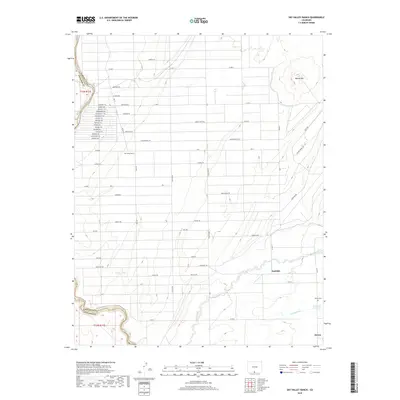
2019 Map of Sky Valley Ranch
USGS Topo · Published 2019About this map
The Rio Grande defines the western border of this high-altitude landscape where the Conejos and Costilla county lines meet. Irrigation is central to this agricultural region, evidenced by the Jaroso Ditch, Anderson Reservoir, and the meandering path of Costilla Cr. The settlement of Jaroso sits in the southeast corner, adjacent to the Jaroso Cem, while Eastdale serves as another focal point for the surrounding farm and ranch land.
Find a feature on this map
66 named features on this map. Tap any name to fly to it.
Don’t see what you’re looking for? This feature index may not catch every label — zoom into the map to look around manually.
Map Details
Editions of this 2019 Sky Valley Ranch Map
This is the sole edition of this map. No revisions or reprints were ever made.
Other maps of this area

1954 · Raton
USGS Topo · 1:250,000

1954 · Trinidad
USGS Topo · 1:250,000

1955 · Trinidad
USGS Topo · 1:250,000

1958 · Raton
USGS Topo · 1:250,000

1958 · Trinidad
USGS Topo · 1:250,000

1959 · Trinidad
USGS Topo · 1:250,000

1963 · Costilla
USGS Topo · 1:24,000

1963 · Ute Mountain
USGS Topo · 1:24,000
1963 · La Segita Peaks NE
USGS Topo · 1:24,000

1967 · Manassa NE
USGS Topo · 1:24,000