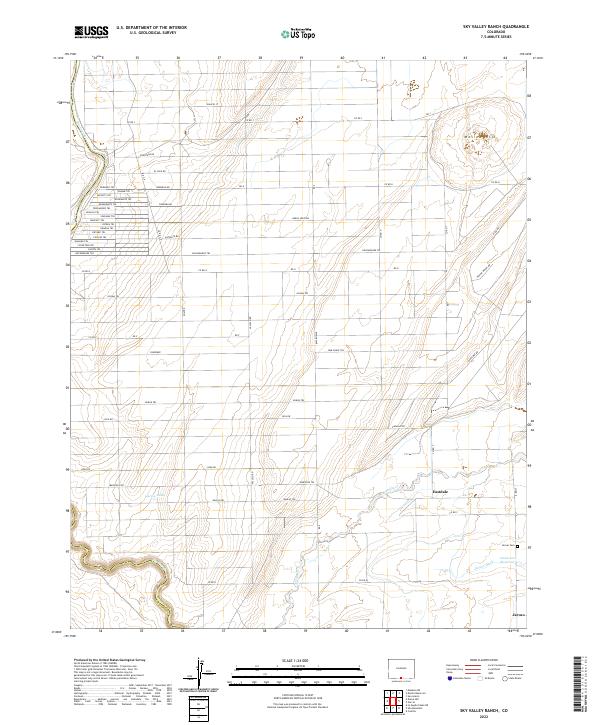
2022 Map of Sky Valley Ranch
USGS Topo · Published 2022About this map
Jaroso and Eastdale sit within a strictly organized landscape of the San Luis Valley, where an extensive grid of numbered and named roads defines the terrain. The presence of the Jaroso Cem and the complex irrigation network, including the Jaroso Ditch, Costilla Cr, and Anderson Reservoir, reflects a long-standing agricultural dependence on water management in this arid region. The boundary between Costilla Co and Conejos Co is marked by the course of the Rio Grande, which carves through the western edge of the quadrangle.
Find a feature on this map
65 named features on this map. Tap any name to fly to it.
Don’t see what you’re looking for? This feature index may not catch every label — zoom into the map to look around manually.
Map Details
Editions of this 2022 Sky Valley Ranch Map
This is the sole edition of this map. No revisions or reprints were ever made.
Other maps of this area

1954 · Raton
USGS Topo · 1:250,000

1954 · Trinidad
USGS Topo · 1:250,000

1955 · Trinidad
USGS Topo · 1:250,000

1958 · Raton
USGS Topo · 1:250,000

1958 · Trinidad
USGS Topo · 1:250,000

1959 · Trinidad
USGS Topo · 1:250,000

1963 · Costilla
USGS Topo · 1:24,000

1963 · Ute Mountain
USGS Topo · 1:24,000
1963 · La Segita Peaks NE
USGS Topo · 1:24,000

1967 · Manassa NE
USGS Topo · 1:24,000