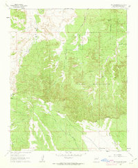
1960 Map of Sky Village NE
USGS Topo · Published 1963About this map
The Zia Indian Reservation dominates this landscape in Sandoval County, characterized by a complex drainage system that defines the local geography. The map illustrates the northern reaches of the Zia Pueblo Grant Boundary, where the terrain is carved by numerous watercourses such as the Arroyo de Piedra Parada and Arroyo de las Milpas. The presence of the Tenorio Ranch and Laguna de Baca suggests the historical importance of water management and livestock in this arid environment.
Find a feature on this map
16 named features on this map. Tap any name to fly to it.
Don’t see what you’re looking for? This feature index may not catch every label — zoom into the map to look around manually.
Map Details
Editions of this 1960 Sky Village NE Map
2 editions found
Other maps of this area

1888 · Bernalillo
USGS Topo · 1:125,000

1889 · Albuquerque
USGS Topo · 1:125,000

1890 · Jemes
USGS Topo · 1:125,000

1892 · Jemes
USGS Topo · 1:125,000

1893 · Albuquerque
USGS Topo · 1:125,000

1939 · San Ysidro
USGS Topo · 1:62,500

1943 · San Ysidro
USGS Topo · 1:62,500

1943 · Jemez
USGS Topo · 1:62,500

1952 · Jemez
USGS Topo · 1:62,500

1953 · Bernalillo NW
USGS Topo · 1:24,000