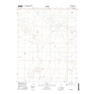
2017 Map of Skyline Rim
USGS Topo · Published 2017About this map
Muddy Creek meanders across the high desert terrain of the Skyline Rim in this southern Utah landscape. The map shows a region defined by dramatic geological features and an extensive network of access roads, reflecting the area's importance for local management and exploration. Named terrain features like Factory Bench and the Lower Blue Hills illustrate the complex topography that separates these arid plateaus. In the northern reaches, Coal Mine Wash and Big Wild Horse Mesa provide evidence of the region's named landmarks, while the southern portion features the North Pinto Hills and the remote White Rock Reservoir. This survey provides a record of the backcountry road systems, such as Cow Dung Rd and Skyline View Rd, which facilitate travel through the high-elevation benches and deep washes of Emery and Wayne counties.
Find a feature on this map
31 named features on this map. Tap any name to fly to it.
Don’t see what you’re looking for? This feature index may not catch every label — zoom into the map to look around manually.
Map Details
Editions of this 2017 Skyline Rim Map
This is the sole edition of this map. No revisions or reprints were ever made.
Other maps of this area

1885 · San Rafael
USGS Topo · 1:250,000

1952 · Wild Horse
USGS Topo · 1:62,500

1953 · Temple Mtn
USGS Topo · 1:62,500

1954 · Stinking Springs Creek 4 SW
USGS Topo · 1:24,000

1954 · Stinking Spring Creek 3 SE
USGS Topo · 1:24,000

1954 · Stinking Spring Creek 3 SW
USGS Topo · 1:24,000

1954 · Mt. Ellen 2 SE
USGS Topo · 1:24,000

1954 · Mt. Ellen 2 SW
USGS Topo · 1:24,000

1954 · Mt. Ellen 1 NW
USGS Topo · 1:24,000

1954 · Mt. Ellen 2 NE
USGS Topo · 1:24,000