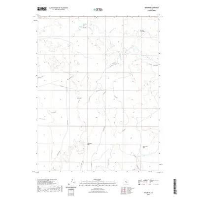
2020 Map of Skyline Rim
USGS Topo · Published 2020About this map
Muddy Creek and Wild Horse Cr carve through this high desert landscape, defining a region where water and relief dictate the path of travel. The topographic detail highlights prominent mesas and drainages, such as Big Wild Horse Mesa and the aptly named Coal Mine Wash, which hints at the area's geological and resource history. A complex network of backroads, including Skyline View Rd and Coal Mine Rd, provides access across the distinct shelf of the Skyline Rim and down into the Lower Blue Hills. Farther south, the North Pinto Hills rise near the White Rock Reservoir, showing the subtle water management infrastructure in this arid part of Emery County. The convergence of these primitive routes at Factory Bench illustrates how the natural topography has historically shaped movement through this interior basin.
Find a feature on this map
25 named features on this map. Tap any name to fly to it.
Don’t see what you’re looking for? This feature index may not catch every label — zoom into the map to look around manually.
Map Details
Editions of this 2020 Skyline Rim Map
This is the sole edition of this map. No revisions or reprints were ever made.
Other maps of this area

1885 · San Rafael
USGS Topo · 1:250,000

1952 · Wild Horse
USGS Topo · 1:62,500

1953 · Temple Mtn
USGS Topo · 1:62,500

1954 · Stinking Springs Creek 4 SW
USGS Topo · 1:24,000

1954 · Stinking Spring Creek 3 SE
USGS Topo · 1:24,000

1954 · Stinking Spring Creek 3 SW
USGS Topo · 1:24,000

1954 · Mt. Ellen 2 SE
USGS Topo · 1:24,000

1954 · Mt. Ellen 2 SW
USGS Topo · 1:24,000

1954 · Mt. Ellen 1 NW
USGS Topo · 1:24,000

1954 · Mt. Ellen 2 NE
USGS Topo · 1:24,000