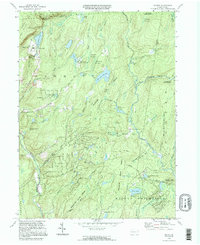
1994 Map of Skytop
USGS Topo · Published 1995About this map
Skytop and the surrounding high country of the Delaware State Forest define this 1990s-era landscape on the Pike and Monroe County line. The area is characterized by a dense network of upland water features and recreational camps, including Camp Canadensis and the Hiawatha Club. Notable hydrological landmarks such as Mountain Lake, Browns Lake, and the cascading waters of Indian Ladder Falls punctuate the timbered terrain, while the southern reach shows the beginnings of Marshalls Creek.
Find a feature on this map
64 named features on this map. Tap any name to fly to it.
Don’t see what you’re looking for? This feature index may not catch every label — zoom into the map to look around manually.
Map Details
Editions of this 1994 Skytop Map
This is the sole edition of this map. No revisions or reprints were ever made.
Other maps of this area

1919 · Pocono
USGS Topo · 1:62,500

1921 · Pocono
USGS Topo · 1:62,500

1923 · Pocono
USGS Topo · 1:62,500

1924 · Bushkill
USGS Topo · 1:48,000

1928 · Ariel
USGS Topo · 1:62,500

1932 · Ariel
USGS Topo · 1:62,500

1935 · Hawley
USGS Topo · 1:62,500

1938 · Hawley
USGS Topo · 1:62,500

1943 · Bushkill
USGS Topo · 1:62,500

1943 · Pocono
USGS Topo · 1:62,500
Featured Places
- Greene Township, PA
- Porter Township, PA
- Paradise Township, PA
- Middle Smithfield Township, PA
- Cresco, Barrett Township